


© Copyright 2016 3D Services (South East) Ltd
Laser Scanning & 3D Modelling
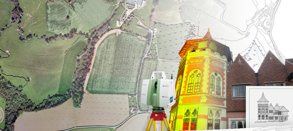
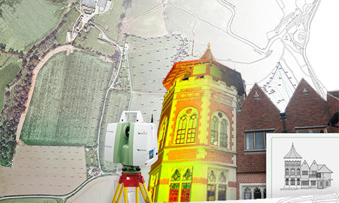
3D laser scanning is an effective and precise way of creating an accurate and highly defined survey. It can be used in conjunction with traditional survey equipment or Total Stations, although, it can also be used on hazardous, inaccessible or busy sites where traditional methods may not be suitable or obstruct day to day works. Rapid data collection allows the job to be completed efficiently with a fewer return visits to site to verify data. The large number of points per second at a high accuracy allows the data to be recorded with exceptionally high confidence. The point clouds can be processed for use as extremely accurate 2D drawings, 3D models for CAD or high quality 3D BIM models using Revit. There is a large variety of jobs that we can undertake using a laser scanner, including; • Rights of Light Reports • Detailed Elevation Surveys • Building Facades • Heritage Buildings • Artefact Archives • Archaeological Sites • Bridges, Roads and Quarries • Building Information Modelling (BIM) • Volumetric Surveys • Monitored Building/Land Surveys • As-Built Engineering and Construction Surveys


© Copyright 2016 3D Services (South East) Ltd
Laser Scanning
3D laser scanning is an effective and precise way of creating an accurate and highly defined survey. It can be used in conjunction with traditional survey equipment or Total Stations, although, it can also be used on hazardous, inaccessible or busy sites where traditional methods may not be suitable or obstruct day to day works. Rapid data collection allows the job to be completed efficiently with a fewer return visits to site to verify data. The large number of points per second at a high accuracy allows the data to be recorded with exceptionally high confidence. The point clouds can be processed for use as extremely accurate 2D drawings, 3D models for CAD or high quality 3D BIM models using Revit. There is a large variety of jobs that we can undertake using a laser scanner, including; • Rights of Light Reports • Detailed Elevation Surveys • Building Facades • Heritage Buildings • Artefact Archives • Archaeological Sites • Bridges, Roads and Quarries • Building Information Modelling (BIM) • Volumetric Surveys • Monitored Building/Land Surveys • As-Built Engineering and Construction Surveys


